METAR reports give weather forecasts for the area near the airport.
If you’re not located near an airport, this report wouldn’t be that helpful.
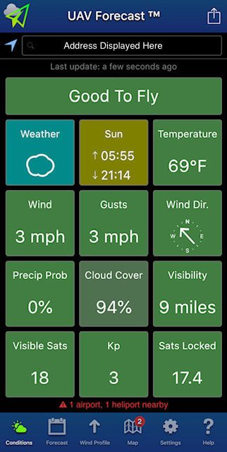
We like using a (free) app called UAV Forecast which provides the current weather information for the area where you are actually located. It shows visibility, wind speed and gusts, and provides a onscreen notice when winds are 20 mph or greater. One other feature that is helpful is the ‘wind profile’ which informs you of the wind speed and gust speed at various altitudes. As you might imagine, wind speeds can vary quite bit from take-off height up to 400 ft. AGL.

Related articles
- In a METAR or TAF report, What does the acronym ‘BECMG’ mean?
- Are we expected to know everything on the METAR and TAF reports, and in sequence? Will we get a METAR or TAF code glossary during our FAA exam?
- When I look at Figure 15 (Terminal Aerodrome Forecasts, or TAF), what do numbers like 1218/1324, 1220/1222, and 1306/1308 represent?

