In this article, we’re going to cover how to survey or inspect a tower with a drone.
Our goal is to make this resource as hands-on as possible in order to help you understand how people are actually using drones in the field to survey towers.
Communication companies with cell and radio towers, cities with water towers, and other industries that use towers as part of their daily operations—all of these towers require regular maintenance, and before the maintenance work can be done, a preliminary survey must be conducted to determine where to work.
More and more, the surveys being conducted to determine what maintenance is needed are being conducted via drone.
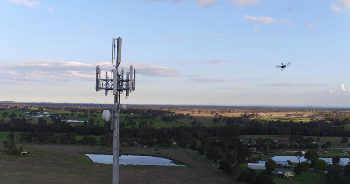
When it comes to tower surveys, a drone can help identify potential climbing hazards, find structural damage, and help tower inspectors understand the tools they need prior to climbing.
Once this information has been gathered, a tower inspector can follow up and address the issues revealed in the data, if any.
Drone surveys serve to reduce the amount of time personnel are on the tower, increasing their efficiency and keeping them safe.
Want to skip straight to the section that concerns you most? No problem:
- Why a Drone?
- Drone Tower Survey Use Cases
- Case Studies and Field Work
- Setting Flight Goals
- Tower-Specific Flight Considerations
- Hardware Considerations
- Software Considerations
- Flight Operations Management
Why a Drone?
Drones are changing the game in the communications tower industry from a safety, quality and efficiency perspective.
– Jacob Cowart, Phoenix Tower Service, LLC
Before we dive into the details, it’s important first to address the question of why you would want to use a drone to survey a tower instead of having a person do the job.
We are still in an early-adoption stage right now in the drone industry, and many companies need to be convinced of the value of using a drone instead of a person when it comes to commercial applications, like surveying a tower.
Of course, if you’re reading this article you probably already know why a drone is a better option than a person for surveying a tower. But if you plan to pitch your services, it’s good to have a list of reasons to help you make your case.
Here are the primary reasons why a drone is a better choice than a person when it comes to surveying a tower:
- Safety. Of course! If a drone crashes, the resulting loss can be measured in dollars, not in life or livelihood. The less time a person is on a tower, the better.
- Speed. Not only is a drone a safer option, but it can also do the job much quicker than a person. You don’t have to think too hard to compare the speed of a drone in flight to that of a person climbing.
- Thoroughness. A drone can collect enough data in a few short flights to create a thorough 3D map of the tower being inspected. In addition, new software is being created by companies like Intel that can take a 3D map and identify changes from a prior 3D map, immediately revealing places where degradation may have happened since the previous inspection.
- Cost. Liability insurance is expensive, and so are the personnel costs associated with training someone to do a manual tower inspection, as well as the hours required to actually do the inspections. Since drones are faster and much less risky in terms of liability, they are more cost-effective.
- Identifying Hazards. Beehives and bird nests can be found in towers, and encountering hazards like these hundreds of feet in the air can be extremely dangerous, both for the person and for the animal. In some instances, the bird in question may be endangered, and disturbing its nest could negatively impact the likelihood of its survival. With a drone, these concerns are removed.
Drone Tower Survey Use Cases
This video from the National Association of Tower Erectors (NATE) provides a good overview of why and how drones are useful for tower inspections.
Use Cases
- Identifying environmental or other hazards before climbing (bee, birds, structural damage, etc.)
- Identifying damaged areas
- Pre-work inspection to determine the tools and parts needed ahead of a climb, to avoid time wasted returning to the ground to find the right tool
- In the case of a structural emergency, you can investigate the structure’s integrity before you climb, and find out if it’s safe to climb at all
Case Studies and Field Work
It’s always helpful to learn from people who have been there before.
Below are some condensed case studies as well as videos from the field, shared in order to provide concrete examples of drones being used for tower surveys/inspections.
Case Study: Telecommunications Tower Survey for Designing New Tower Mount
Project Goal: Identify, analyze, and design a new antenna mount for the tower.
Mission: Ryka UAS, a professional drone service company located in Seattle, WA, was hired to survey a telecommunications tower and create a high-definition 3D point cloud that could be used as a model for designing a new antenna mount for the tower.
Timeline: It took only one day to capture the images and process them into a precise 3D point cloud (shown below), which focused on the upper rad center mounts, wireless-panel style antennas, and associated mounts.
Project Deliverable: A 3D densified point cloud created on Pix4Dmapper (shown below).
Note: This case study was originally published on the Pix4D website. Read the full case study here.
Case Study: Cell Tower Inspection
Project Goal: Collect highly detailed visual data regarding the condition of a cell phone tower.
Mission: The Unmanned Vehicle Technologies team used a drone to collect clear, accurate visual data on the state of a cell phone tower. Using a camera that allows for high accuracy while zooming, they were able to fly at a significant distance from the cell tower and still collect clear, usable images. Skip to 1:07 in the video below to see how the pilot uses the “point of interest” flight mode to circle the cell phone tower, maintaining an equal distance from the tower while collecting detailed visual data.
Timeline: The timeline is unclear, but it seems that all of the data needed was collected in a single flight.
Deliverables: Visual data that can be used to analyze the condition of the cell tower.
Video: Transmission Tower Inspection
This video shows footage from a test flight conducted for the inspection of a transmission tower. It’s important to note the zoom used here—at the beginning of the video you can see that the drone is flying at a fairly significant distance away from the tower, and the pilot zooms in to get clear, accurate visual data on the transmission tower.
Zoom is a crucial feature for cameras used in tower inspections, since, due to guy wires and electromagnetic fields, you want to avoid flying close to the tower you’re surveying. Note that the pilot switches from digital zoom to optical zoom at 1:36, providing a clearer resulting image.
Video: Power Line Pylon Inspection
OK, power line pylons aren’t exactly towers, but they present many of the same technical challenges as surveying towers. Doing manual inspections of the pylons that support power lines can be incredibly difficult and dangerous, especially when they cover mountainous terrain.
This video shows how inspectors in China’s Yunnan Province are using drones to make their jobs faster and more efficient. Using a drone, inspectors have gone from inspecting one or two pylons a day to inspecting ten to twenty a day.
Setting Flight Goals
Before conducting your mission it’s important to have your objectives clearly defined.
If you’re doing freelance work, the company you’re working for may hand you a list of goals for your tower survey, but it’s always good to be prepared with your own goals in case your client is disorganized or uncertain about what the outcomes should be for your mission.
On the other hand, you might be working to incorporate sUAS into an existing tower inspection operation, and seeking resources to operationalize the effort. Either way, these examples should come in handy when you’re trying to create clear, concrete objectives for your tower survey.
Here are three general examples of tower surveying flight goals:
1. Pre-work inspection. Use data collected via drone to determine what types of tools will be required for the tower inspector to do his or her job.
2. Hazard and obstacle analysis. Use data collected via drone to determine potential biological (i.e., bees or birds) or structural hazards (i.e., weak areas in the tower) or obstacles. The presence of a bird’s nest may not always be a danger to the tower inspector, but if it’s an endangered species it could present other legal and ethical concerns.
3. Structural analysis. Use data collected via drone to find degradations in the tower’s structure, and identify areas where work is required.
We encourage you to work with your clients (or supervisor, if you’re part of an internal team at a larger company) to take these general goals and create specific goals around the project in question.
Is there a certain area of the tower that was showing degradation in the past, and is a concern? Are you aware of a bird’s nest in a certain location that was found on the tower last time it was inspected, and want to know if it’s still there? Is the tower inspector concerned about knowing exactly which tools are going to be needed for the job before making the climb?
Asking questions like these before a flight can help to hone in on the specific outcomes desired, and ensure that the mission is a success.
Tower-Specific Flight Considerations
When planning your mission, there are some tower-specific factors to keep in mind.
A Collaborative Effort
Unlike other kinds of surveying, where a drone pilot might be out in the field alone with possibly one or two other flight ops team members, surveying a tower is usually a collaborative effort.
In many tower survey scenarios, a tower inspector or a team of inspectors will be on site with the drone pilot. The inspector(s) may watch the live feed from the drone and provide input in order to collect the information he or she needs in order to do his or her job more efficiently.
This is all to say that you should be ready to work as a member of a team when conducting a tower survey by drone, and not as a lone operator.
Height / Airspace Authorization
Regarding how high you can fly and the Part 107 restriction on flights above 400 feet, According to the FAA:
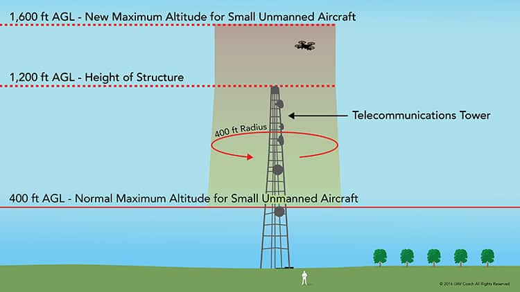
The maximum allowable altitude is 400 feet above the ground, and higher if your drone remains within 400 feet of a structure.
In short, even though the Part 107 rules prohibit flights over 400 feet in the air, a drone pilot surveying a tower may fly the full height of the tower as well as an additional 400 feet above the top of the tower (as illustrated in the image below).
This being said, it’s crucial to know your airspace. In some instances, flying 400 feet above a tower may place you in controlled airspace even though you took off in uncontrolled airspace, so it’s important to make sure you do your research before flying.
Need help with getting permission to fly in Class B, C, D or E airspace? Check out our airspace authorization guide over here.
And of course, it’s always important to use good judgment. If for some reason the tower you’re inspecting is close to other structures that might pose a hazard, fly carefully, or not at all if you have serious safety concerns.
Wind
Wind speed can be a huge factor for tower surveys, especially for extremely high flights. Keep in mind that the conditions near the ground, or at 30 feet in the air, will be nothing like the conditions at 1,200 or 1,900 feet.
If it’s breezy on the ground, it might be incredibly windy once you get to the top of the tower.
We always encourage pilots to be cautious and to cancel a mission if the conditions are not safe. Better to come back another day than to risk a crash that could ruin your drone or injure someone.
Flight Paths and Safety Concerns for Guyed and Other Towers
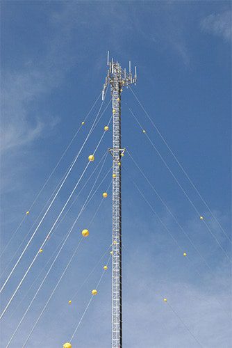
When surveying a guyed tower (pictured below—this is a tower supported by wires leading diagonally to the ground), make sure to fly vertically up one face at a time, keeping between the guy paths.
Guy wires can extend up to 2,000 feet into the air, so it’s essential that you look out for them when surveying a guyed tower.
Alternately, when surveying any other type of tower—be it a water tower or a monopole tower—always keep your sUAS between you and the tower in order to maintain optimum visibility.
Electromagnetism and Distance from the Tower
AM towers, FM/TV antennas, and even cellular and microwave antennas can all emit powerful electromagnetic fields at close range. These fields could interfere with your control signal and can cause your drone to malfunction and crash.
Make sure to stay a safe distance away from the tower throughout your flight, and you should be good to go.
Battery Life
Many towers are so tall that it might take two to three minutes of flight time to reach the top.
Make sure to use realistic time projections when planning your flight, and use a battery with a long enough life for the mission you’re planning.
Use a Visual Observer (VO)
Whenever possible, use a Visual Observer (VO) to help you maintain a safe distance from the tower and from any passers-by.
Although this isn’t always possible, it is certainly a helpful thing to have a second set of trained eyes on hand.
Hardware Considerations
There are some amazing professional drones out there, and many of them are a good fit for doing tower surveys.
The drones listed below vary in price from about $2,000 all the way up to $40,000 (woah!).
For solopreneurs, DJI’s Mavic 2 Pro or Enterprise series or Yuneec’s H520 are great drones, and will work well to get the job done. Bigger companies looking for high-end hardware might be more interested in DJI’s Matrice 210 (dual gimbals for twice the power!) or the heavy-lifter Matrice 600.
DJI’s Mavic 2 Enterprise Advanced
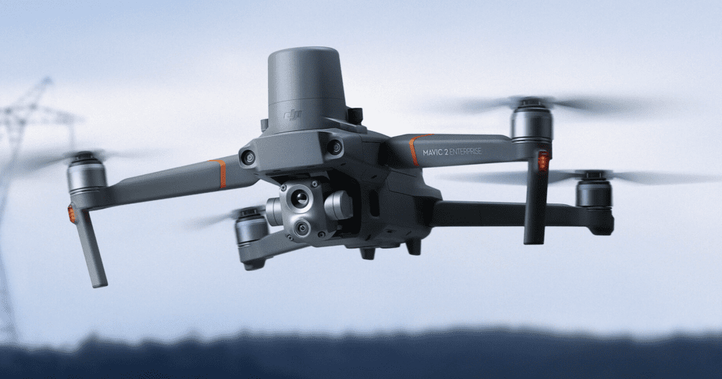
DJI’s Mavic Enterprise Advanced is a great option for professional surveying and inspections. The Mavic 2 Enterprise Advanced has a good battery life at 31 minutes, and its 3-axis gimbal and dual-camera allows you to toggle between a powerful daylight and thermal camera. At a price just over $6K, it’s design for serious commercial applications. It includes several modular accessories (spotlight, speaker, and flashing light). For a more affordable option, look to the Mavic 2 Pro.
Cost: $6,900
Yuneec’s H520
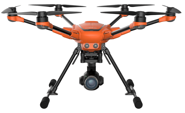
Yuneec’s H520 is a hexacopter developed specifically for commercial use. The H520 has a flight time of 25 to 28 minutes (depending on the weight of the camera being used) and allows you to swap out the camera system with three different Yuneec cameras: the E90, the CGO, and the E50. It was made specifically for inspections and surveys, among other applications, and is a great mid-range option for surveying towers.
Cost: $1,999
DJI’s Matrice 300
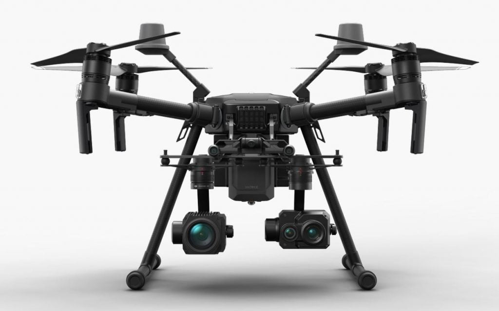
DJI’s Matrice 300 is designed to safely operate in the most challenging circumstances. Some of its safety features include an anti-collision beacon, object detection up to 98 feet away, and AirSense, which is an ADS-B receiver that picks up signals from manned aircraft and alerts the drone pilot of the location of the aircraft. It’s compatible with the two new Zenmuse H20 cameras and various other sensors. The H20 series have optical and thermal sensors, making it a compelling choice for a variety of commercial applications.
Cost: $13,700
DJI’s ZenMuse Z30 Camera for Tower Inspections
The cameras that come with the drones listed above can all do the job of surveying a tower just fine, but DJI’s ZenMuse Z30 was designed specifically with tower inspections in mind, so we’d be remiss if we didn’t call it out here.
When it comes to tower surveys, the most important thing a camera needs to be able to do is maintain clarity and accuracy when zooming, so that the drone can fly at a safe distance from the tower and still get crystal clear images of small parts of the asset. The Z30 is designed to do exactly that.
According to DJI, the Z30 is “the first integrated aerial camera with an optical zoom up to 30x and digital up to 6x.” Watch the video below to see the Z30 in action.
Software Considerations
After you’ve collected images with your sUAS, it’s important to have the right software to process them into usable data.
Here are the top software options out there for processing images collected via drone:
- Pix4D is a go-to in the industry for UAV image processing. Their desktop software is a complete mapping and modeling solution that automatically converts aerial images into 2D mosaics and 3D models.
- DroneDeploy offers powerful cloud-based drone software that’s compatible with any drone. It allows you to map and create 3D models and analyze and share the data right from your device.
- PrecisionMapper was created by Precision Hawk, and automatically processes aerial data into 2D and 3D products. One noteworthy feature of this software is that it’s now free (it previously cost up to $450 a month for a plan with unlimited data storage). For those of you trying to grow your own solopreneur operation, this might be a good budget-conscious option.
- ArcGIS began as 3D Robotics’ flagship data processing platform, SiteScan before being sold to the powerful mapping solution provider, ESRI. It enables pilots to quickly generate a survey of any site quickly and cost-effectively. With a few taps on a tablet, any pilot can generate orthophotos, point clouds, and meshes to build design surfaces and contours.
Looking for flight ops management software? Here are our top pics:
- Aloft (formerly Kittyhawk) is a one-stop-shop for flying, logging, and coordinating UAV operations. They have a strong focus on providing value for their pilots, which manifests in the usability of their platform and the fact that they allow for unlimited logging of hours.
- DroneLogbook is a flight management platform for UAV Pilots. They focus on automating log collections, by supporting more than 20 different UAV log file types. They also have features to manage equipment, battery, maintenance, incident, location, pre-flight documents. DroneLogBook supports a spectrum of UAV pilots, from hobbyists to large companies.
Flight Operations Management
(Looking for flight ops management software? Scroll up!)
Here are some key operational considerations for planning your tower survey.
Airspace / Scene Research
Do the research ahead of time to ensure the tower you’ll be surveying isn’t located in restricted airspace. If you do need to fly in restricted airspace, make sure to get airspace authorization for the flight.
Also, look at the scene where the tower is located ahead of time to identify any potential obstacles or hazards before you fly.
Other Permissions / Notifications
Make sure to secure permission from the tower owner before flying a mission.
Insurance
If flying as a freelancer, we recommend looking into insurance for you and your drone.
If flying as a full-time employee of a company that has created an sUAS program, confirm that your company has the proper insurance for conducting commercial drone operations before flying.
Pre-flight Inspection
Make sure to follow the pre-flight guidelines found in your owner’s manual concerning all protocols for pre-flight inspections. These protocols may vary from one drone to another, so make sure to refer to your owner’s manual for the specific steps needed.
Flight Ops Best Practices
When starting your flight, hover in the air for 30 seconds before starting the mission. This will give you the chance to detect any potential issues with the drone before you start.
Make sure to keep the drone in sight at all times. If you’re using a Visual Observer, make sure you have agreed on terminology and communication procedures during flight beforehand, and use them faithfully while in the air.
Always make sure to follow FAA regulations, including the prohibition against flights over people not directly involved in the mission. If someone walks into your site of operation, alert them to the ongoing mission and ask them to move on.
Also, don’t forget to have your Return Home Function set up, and keep the path home clear in case you need to use it.
